 AGRI BRIGHT
Current Status
Where is the vessel?
AGRI BRIGHT is currently in 328 nm NW of Sapiranga, based on AIS data received about 15h ago.
Latest AIS update:
Current position: 25.17829° S, 28.68562° W (328 nm NW of Sapiranga)
Average speed (last 7 days): Loading…
Average speed (last 30 days): Loading…
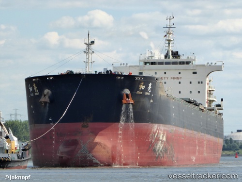
Vessel profile: AGRI BRIGHT is a Bulk Carrier with dimensions 225m x 32m.
This page combines live AIS, route history, probable destination signals, nearby traffic, and port activity for practical vessel monitoring.
The current position of vessel AGRI BRIGHT is -25.17829 lat / -28.68562 lng. Updated: 2026-07-08 07:14:19 UTCNearest reference points:
- Open sea, approx. 415 nm off the nearest listed port
- Open sea, approx. 405 nm off the nearest listed port
- Open sea, approx. 410 nm off the nearest listed port
Currently sailing under the flag of Marshall Islands ![]()
AGRI BRIGHT built in 2013 year
Deadweight:
74632 tDetails:
Live Vessel AGRI BRIGHT Analytics (details, animations, etc.)
Recent AIS points (UTC):
2026-07-08 03:25:50 UTC · -24.90242, -29.25766 · SOG 8.7 kn · COG 113°2026-07-08 04:45:06 UTC · -24.98333, -29.05167 · SOG 9 kn · COG -1°
2026-07-08 06:33:04 UTC · -25.12167, -28.78333 · SOG 9 kn · COG -1°
2026-07-08 07:14:19 UTC · -25.17829, -28.68562 · SOG 9.7 kn · COG 123°