 BLUE CECIL
Current Status
Where is the vessel?
BLUE CECIL is currently in Near Cringila, based on AIS data received about 14h ago.
Latest AIS update:
Current position: 34.45333° S, 150.89333° E (Near Cringila)
Average speed (last 7 days): Loading…
Average speed (last 30 days): Loading…
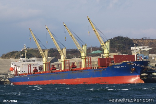
Vessel profile: BLUE CECIL is a Bulk Carrier with dimensions 177m x 28m.
This page combines live AIS, route history, probable destination signals, nearby traffic, and port activity for practical vessel monitoring.
The current position of vessel BLUE CECIL is -34.45333 lat / 150.89333 lng. Updated: 2026-05-23 01:46:54 UTCNearest reference points:
- Near Sydenham
- Near Balmain
- Near DRUMMOYNE SYDNEY
Currently sailing under the flag of Marshall Islands ![]()
BLUE CECIL built in 2004 year
Deadweight:
32564 tDetails:
Live Vessel BLUE CECIL Analytics (details, animations, etc.)
Recent AIS points (UTC):
2026-05-22 22:02:59 UTC · -34.45405, 150.89389 · SOG 0 kn · COG 178°2026-05-22 22:52:49 UTC · -34.45333, 150.89333 · SOG 0 kn · COG -1°
2026-05-22 23:37:49 UTC · -34.45333, 150.89333 · SOG 0 kn · COG -1°
2026-05-23 01:46:54 UTC · -34.45333, 150.89333 · SOG 0 kn · COG -1°