 vesseltracker.com
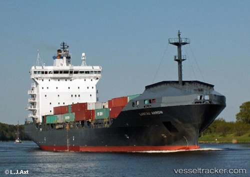
 MORAGA
Current Status
Where is the vessel?
MORAGA is currently in Near Burgas, based on AIS data received less than 1h ago.
Latest AIS update:
Current position: 42.48466° N, 27.46413° E (Near Burgas)
Average speed (last 7 days): Loading…
Average speed (last 30 days): Loading…
Vessel profile: MORAGA is a Container Ship with dimensions 159m x 26m.
This page combines live AIS, route history, probable destination signals, nearby traffic, and port activity for practical vessel monitoring.
The current position of vessel MORAGA is 42.48466 lat / 27.46413 lng. Updated: 2026-05-13 19:15:33 UTCNearest reference points:
- Near Beloslav
- Near Ignatievo
- Near Varna
Currently sailing under the flag of Marshall Islands ![]()
MORAGA built in 2001 year
Deadweight:
14901 tDetails:
Live Vessel MORAGA Analytics (details, animations, etc.)
Recent AIS points (UTC):
2026-05-13 16:24:33 UTC · 42.48466, 27.46413 · SOG 0 kn · COG 203°2026-05-13 17:09:35 UTC · 42.48465, 27.46412 · SOG 0 kn · COG 203°
2026-05-13 18:18:34 UTC · 42.48464, 27.46415 · SOG 0 kn · COG 203°
2026-05-13 19:15:33 UTC · 42.48466, 27.46413 · SOG 0 kn · COG 203°