 VIKING PASSAMA
Current Status
Where is the vessel?
VIKING PASSAMA is currently in Near PYEONGTAEK, based on AIS data received about 14h ago.
Latest AIS update:
Current position: 36.98085° N, 126.82570° E (Near PYEONGTAEK)
Average speed (last 7 days): Loading…
Average speed (last 30 days): Loading…
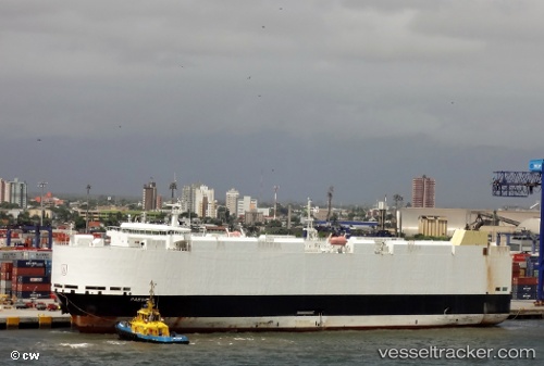
Vessel profile: VIKING PASSAMA is a Vehicles Carrier with dimensions 30m x 182m.
This page combines live AIS, route history, probable destination signals, nearby traffic, and port activity for practical vessel monitoring.
The current position of vessel VIKING PASSAMA is 36.98085 lat / 126.82570 lng. Updated: 2026-05-25 01:33:09 UTCNearest reference points:
- Near PYEONGTAEK
- Near Dangjin
- Near Incheon
Currently sailing under the flag of Marshall Islands ![]()
VIKING PASSAMA built in 2012 year
Deadweight:
12806 tDetails:
Live Vessel VIKING PASSAMA Analytics (details, animations, etc.)
Recent AIS points (UTC):
2026-05-24 22:59:50 UTC · 36.98085, 126.82569 · SOG 0 kn · COG -1°2026-05-24 23:50:22 UTC · 36.98085, 126.82569 · SOG 0 kn · COG -1°
2026-05-25 01:10:02 UTC · 36.98085, 126.82570 · SOG 0 kn · COG -1°
2026-05-25 01:33:09 UTC · 36.98085, 126.82570 · SOG 0 kn · COG 332°