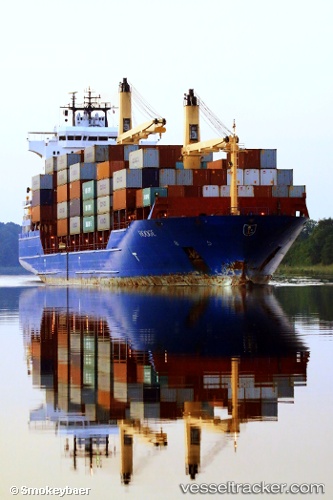
 EAGLE II
Current Status
Where is the vessel?
EAGLE II is currently in Near Halmstad, based on AIS data received about 14h ago.
Latest AIS update:
Current position: 56.65148° N, 12.84783° E (Near Halmstad)
Average speed (last 7 days): Loading…
Average speed (last 30 days): Loading…
Vessel profile: EAGLE II is a Container Ship with dimensions 161m x 25m.
This page combines live AIS, route history, probable destination signals, nearby traffic, and port activity for practical vessel monitoring.
The current position of vessel EAGLE II is 56.65148 lat / 12.84783 lng. Updated: 2026-06-16 17:36:19 UTCNearest reference points:
- Near Halmstad
- Near FALKENBERG
- Near Viken
Currently sailing under the flag of Marshall Islands ![]()
EAGLE II built in 2006 year
Deadweight:
16986 tDetails:
Live Vessel EAGLE II Analytics (details, animations, etc.)
Recent AIS points (UTC):
2026-06-16 14:30:25 UTC · 56.65148, 12.84785 · SOG 0 kn · COG 269°2026-06-16 16:30:23 UTC · 56.65149, 12.84784 · SOG 0 kn · COG 269°
2026-06-16 16:36:22 UTC · 56.65149, 12.84784 · SOG 0 kn · COG 270°
2026-06-16 17:36:19 UTC · 56.65148, 12.84783 · SOG 0 kn · COG 269°