 EADOW DXL
Current Status
Where is the vessel?
EADOW DXL is currently in 27 nm W of King Abdullah City, based on AIS data received about 14h ago.
Latest AIS update:
Current position: 22.28888° N, 38.61444° E (27 nm W of King Abdullah City)
Average speed (last 7 days): Loading…
Average speed (last 30 days): Loading…
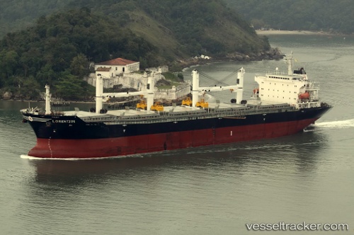
Vessel profile: EADOW DXL is a Bulk Carrier with dimensions m x m.
This page combines live AIS, route history, probable destination signals, nearby traffic, and port activity for practical vessel monitoring.
The current position of vessel EADOW DXL is 22.28888 lat / 38.61444 lng. Updated: 2026-05-22 12:13:51 UTCNearest reference points:
- Near King Abdullah City
- Near King Abdullah
- Near Rabigh
Currently sailing under the flag of Marshall Islands ![]()
Details:
Live Vessel EADOW DXL Analytics (details, animations, etc.)
Recent AIS points (UTC):
2026-05-22 07:59:32 UTC · 22.33791, 38.58107 · SOG 0.8 kn · COG 246°2026-05-22 10:02:01 UTC · 22.31535, 38.59296 · SOG 0.6 kn · COG 228°
2026-05-22 10:59:01 UTC · 22.30562, 38.60189 · SOG 0.8 kn · COG 217°
2026-05-22 12:13:51 UTC · 22.28888, 38.61444 · SOG 1.1 kn · COG 235°