 ALLIED ATLANTIC
Current Status
Where is the vessel?
ALLIED ATLANTIC is currently in 312 nm E of Saint George, based on AIS data received about 15h ago.
Latest AIS update:
Current position: 31.15478° N, 58.75030° W (312 nm E of Saint George)
Average speed (last 7 days): Loading…
Average speed (last 30 days): Loading…
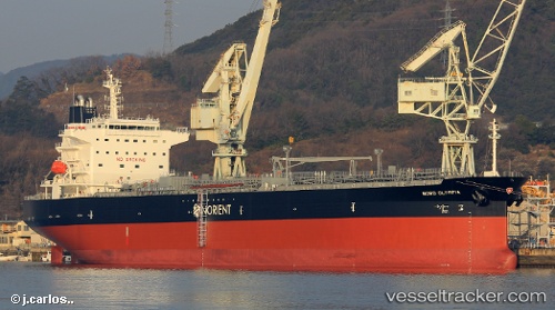
Vessel profile: ALLIED ATLANTIC is a Tanker with dimensions m x m.
This page combines live AIS, route history, probable destination signals, nearby traffic, and port activity for practical vessel monitoring.
The current position of vessel ALLIED ATLANTIC is 31.15478 lat / -58.75030 lng. Updated: 2026-05-20 07:26:28 UTCNearest reference points:
- 311 nm E of Saint George
- 247 nm E of Saint George
- Open sea, approx. 413 nm off the nearest listed port
Currently sailing under the flag of Marshall Islands ![]()
Details:
Live Vessel ALLIED ATLANTIC Analytics (details, animations, etc.)
Recent AIS points (UTC):
2026-05-20 04:51:39 UTC · 31.26944, -58.16997 · SOG 12.1 kn · COG 257°2026-05-20 06:07:01 UTC · 31.21360, -58.45519 · SOG 11.8 kn · COG 256°
2026-05-20 07:10:29 UTC · 31.16671, -58.69033 · SOG 11.9 kn · COG 256°
2026-05-20 07:26:28 UTC · 31.15478, -58.75030 · SOG 11.9 kn · COG 256°