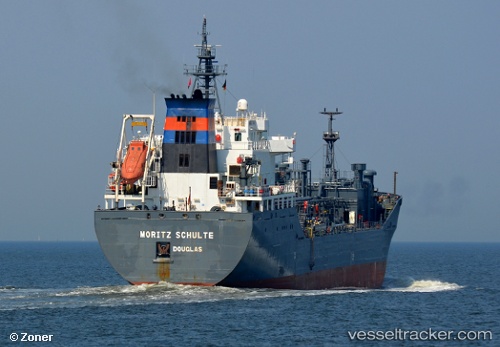
 MORITZ SCHULTE
Current Status
Where is the vessel?
MORITZ SCHULTE is currently in Near Gibraltar, based on AIS data received about 14h ago.
Latest AIS update:
Current position: 36.08512° N, 6.30150° W (Near Gibraltar)
Average speed (last 7 days): Loading…
Average speed (last 30 days): Loading…
Vessel profile: MORITZ SCHULTE is a Lpg Tanker with dimensions m x m.
This page combines live AIS, route history, probable destination signals, nearby traffic, and port activity for practical vessel monitoring.
The current position of vessel MORITZ SCHULTE is 36.08512 lat / -6.30150 lng. Updated: 2026-05-21 07:03:26 UTCNearest reference points:
- Near Gibraltar
- Near Conil de la Frontera
- Near Cadiz
Currently sailing under the flag of Marshall Islands ![]()
Details:
Live Vessel MORITZ SCHULTE Analytics (details, animations, etc.)
Recent AIS points (UTC):
2026-05-21 02:51:27 UTC · 36.08564, -6.30123 · SOG 0 kn · COG 108°2026-05-21 04:06:27 UTC · 36.08581, -6.30105 · SOG 0 kn · COG 109°
2026-05-21 06:09:31 UTC · 36.08579, -6.30110 · SOG 0 kn · COG 112°
2026-05-21 07:03:26 UTC · 36.08512, -6.30150 · SOG 0 kn · COG 105°