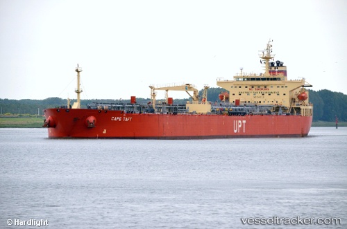
Cape Taft
Current StatusWhere is the vessel?
Cape Taft is currently in 17 nm SE of Pascagoula, based on AIS data received about 17d ago.
Latest AIS update:
Current position: 30.09298° N, 88.43600° W (17 nm SE of Pascagoula)
Average speed (last 7 days): Loading…
Average speed (last 30 days): Loading…
Vessel profile: Cape Taft is a Crude Oil Tanker with dimensions 32m x 228m.
This page combines live AIS, route history, probable destination signals, nearby traffic, and port activity for practical vessel monitoring.
The current position of vessel Cape Taft is 30.09298 lat / -88.43600 lng. Updated: 2026-06-07 16:18:21 UTCNearest reference points:
- Near Pascagoula
- Near BAYOU LA BATRE
- Near Ocean Springs
Details:
Live Vessel Cape Taft Analytics (details, animations, etc.)
Recent AIS points (UTC):
2026-06-07 16:18:21 UTC · 30.09298, -88.43600 · SOG 0 kn · COG -1°