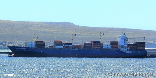
 AS NORA
Current Status
Where is the vessel?
AS NORA is currently in Near Colombo, based on AIS data received about 15h ago.
Latest AIS update:
Current position: 6.94858° N, 79.85262° E (Near Colombo)
Average speed (last 7 days): Loading…
Average speed (last 30 days): Loading…
Vessel profile: AS NORA is a Cargo A with dimensions m x m.
This page combines live AIS, route history, probable destination signals, nearby traffic, and port activity for practical vessel monitoring.
The current position of vessel AS NORA is 6.94858 lat / 79.85262 lng. Updated: 2026-06-02 20:01:36 UTCNearest reference points:
- 19 nm SW of Bataduwa
- 67 nm SW of Moratuwa
- 38 nm SW of Galle
Currently sailing under the flag of Marshall Islands ![]()
Details:
Live Vessel AS NORA Analytics (details, animations, etc.)
Recent AIS points (UTC):
2026-06-02 16:01:36 UTC · 6.94861, 79.85260 · SOG 0 kn · COG 11°2026-06-02 18:05:23 UTC · 6.94833, 79.85333 · SOG 0 kn · COG -1°
2026-06-02 19:34:37 UTC · 6.94859, 79.85262 · SOG 0 kn · COG 11°
2026-06-02 20:01:36 UTC · 6.94858, 79.85262 · SOG 0 kn · COG 11°