 JOLLY DANUBE
Current Status
Where is the vessel?
JOLLY DANUBE is currently in 75 nm SW of Yanbu, based on AIS data received about 14h ago.
Latest AIS update:
Current position: 23.23908° N, 37.01480° E (75 nm SW of Yanbu)
Average speed (last 7 days): Loading…
Average speed (last 30 days): Loading…
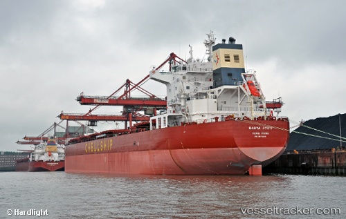
Vessel profile: JOLLY DANUBE is a Bulk Carrier with dimensions m x m.
This page combines live AIS, route history, probable destination signals, nearby traffic, and port activity for practical vessel monitoring.
The current position of vessel JOLLY DANUBE is 23.23908 lat / 37.01480 lng. Updated: 2026-05-21 07:21:19 UTCNearest reference points:
- 74 nm SW of Yanbu
- 95 nm SW of Al Muajjiz
- 30 nm SW of Yanbu
Currently sailing under the flag of Marshall Islands ![]()
Details:
Live Vessel JOLLY DANUBE Analytics (details, animations, etc.)
Recent AIS points (UTC):
2026-05-21 03:52:03 UTC · 23.82795, 36.65011 · SOG 11.6 kn · COG 147°2026-05-21 04:34:49 UTC · 23.70740, 36.72750 · SOG 11.7 kn · COG 149°
2026-05-21 05:26:59 UTC · 23.55878, 36.81695 · SOG 11.7 kn · COG 150°
2026-05-21 07:21:19 UTC · 23.23908, 37.01480 · SOG 11.6 kn · COG 157°