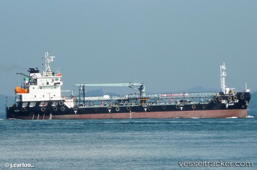
 Marine Pamela
Current Status
Where is the vessel?
Marine Pamela is currently in Near BUKOM ISLAND, based on AIS data received about 15h ago.
Latest AIS update:
Current position: 1.16970° N, 103.76318° E (Near BUKOM ISLAND)
Average speed (last 7 days): Loading…
Average speed (last 30 days): Loading…
Vessel profile: Marine Pamela is a Service Ship with dimensions 79m x 16m.
This page combines live AIS, route history, probable destination signals, nearby traffic, and port activity for practical vessel monitoring.
The current position of vessel Marine Pamela is 1.16970 lat / 103.76318 lng. Updated: 2026-05-25 23:47:55 UTCNearest reference points:
- Near BUKOM ISLAND
- Near JURONG ISLAND
- Near Pasir Panjang Wharves
Currently sailing under the flag of Singapore ![]()
Marine Pamela built in 2012 year
Deadweight:
4993 tDetails:
Live Vessel Marine Pamela Analytics (details, animations, etc.)
Recent AIS points (UTC):
2026-05-25 19:36:32 UTC · 1.16978, 103.76282 · SOG 0 kn · COG 188°2026-05-25 21:25:45 UTC · 1.16972, 103.76284 · SOG 0 kn · COG -1°
2026-05-25 22:32:44 UTC · 1.16962, 103.76325 · SOG 0 kn · COG -1°
2026-05-25 23:47:55 UTC · 1.16970, 103.76318 · SOG 0 kn · COG -1°