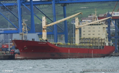
 ATLANTIC NORTH
Current Status
Where is the vessel?
ATLANTIC NORTH is currently in Near Skikid, based on AIS data received about 15h ago.
Latest AIS update:
Current position: 36.88951° N, 6.90246° E (Near Skikid)
Average speed (last 7 days): Loading…
Average speed (last 30 days): Loading…
Vessel profile: ATLANTIC NORTH is a Container Ship with dimensions m x m.
This page combines live AIS, route history, probable destination signals, nearby traffic, and port activity for practical vessel monitoring.
The current position of vessel ATLANTIC NORTH is 36.88951 lat / 6.90246 lng. Updated: 2026-05-25 23:29:16 UTCNearest reference points:
- Near Skikid
- Near Annaba
- Near Carmona
Currently sailing under the flag of Singapore ![]()
Details:
Live Vessel ATLANTIC NORTH Analytics (details, animations, etc.)
Recent AIS points (UTC):
2026-05-25 20:05:16 UTC · 36.88950, 6.90249 · SOG 0 kn · COG 207°2026-05-25 22:23:19 UTC · 36.88951, 6.90246 · SOG 0 kn · COG 207°
2026-05-25 22:26:20 UTC · 36.88951, 6.90246 · SOG 0 kn · COG 207°
2026-05-25 23:29:16 UTC · 36.88951, 6.90246 · SOG 0 kn · COG 207°