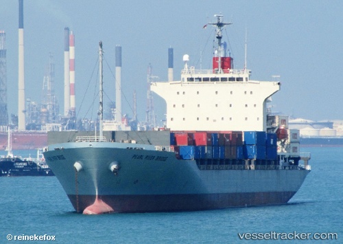
 PEARL RIVER BRIDGE
Current Status
Where is the vessel?
PEARL RIVER BRIDGE is currently in Near Shimizu, based on AIS data received about 14h ago.
Latest AIS update:
Current position: 35.03946° N, 138.51888° E (Near Shimizu)
Average speed (last 7 days): Loading…
Average speed (last 30 days): Loading…
Vessel profile: PEARL RIVER BRIDGE is a Container Ship with dimensions m x m.
This page combines live AIS, route history, probable destination signals, nearby traffic, and port activity for practical vessel monitoring.
The current position of vessel PEARL RIVER BRIDGE is 35.03946 lat / 138.51888 lng. Updated: 2026-05-21 04:03:48 UTCNearest reference points:
- Near Shimizu
- Near OMAEZAKI
- Near Iruma
Currently sailing under the flag of Singapore ![]()
Details:
Live Vessel PEARL RIVER BRIDGE Analytics (details, animations, etc.)
Recent AIS points (UTC):
2026-05-21 01:21:48 UTC · 35.03936, 138.51889 · SOG 0 kn · COG 54°2026-05-21 01:36:48 UTC · 35.03940, 138.51888 · SOG 0 kn · COG 54°
2026-05-21 03:39:48 UTC · 35.03944, 138.51891 · SOG 0 kn · COG 53°
2026-05-21 04:03:48 UTC · 35.03946, 138.51888 · SOG 0 kn · COG 53°