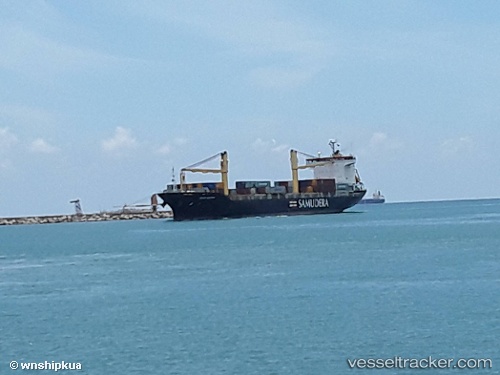
 Sinar Bintan
Current Status
Where is the vessel?
Sinar Bintan is currently in Near Pioneer, based on AIS data received about 23h ago.
Latest AIS update:
Current position: 1.30654° N, 103.68099° E (Near Pioneer)
Average speed (last 7 days): Loading…
Average speed (last 30 days): Loading…
Vessel profile: Sinar Bintan is a Container Ship with dimensions 148m x 28m.
This page combines live AIS, route history, probable destination signals, nearby traffic, and port activity for practical vessel monitoring.
The current position of vessel Sinar Bintan is 1.30654 lat / 103.68099 lng. Updated: 2026-07-09 07:50:55 UTCNearest reference points:
- Near Tuas
- Near Pulau Ayer Chawan
- Near Jurong/Singapore
Currently sailing under the flag of Singapore ![]()
Sinar Bintan built in 2002 year
Deadweight:
14971 tDetails:
Live Vessel Sinar Bintan Analytics (details, animations, etc.)
Recent AIS points (UTC):
2026-07-09 04:15:06 UTC · 1.30656, 103.68103 · SOG 0 kn · COG 173°2026-07-09 05:24:02 UTC · 1.30656, 103.68103 · SOG 0 kn · COG 173°
2026-07-09 06:12:00 UTC · 1.30657, 103.68107 · SOG 0 kn · COG 173°
2026-07-09 07:50:55 UTC · 1.30654, 103.68099 · SOG 0 kn · COG 173°