 vesseltracker.com
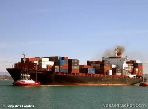
 Maersk Jabal
Current Status
Where is the vessel?
Maersk Jabal is currently in 34 nm E of Atakka Dry Port, based on AIS data received about 3h ago.
Latest AIS update:
Current position: 32.08392° N, 33.66407° E (34 nm E of Atakka Dry Port)
Average speed (last 7 days): Loading…
Average speed (last 30 days): Loading…
Vessel profile: Maersk Jabal is a Container Ship with dimensions 222m x 30m.
This page combines live AIS, route history, probable destination signals, nearby traffic, and port activity for practical vessel monitoring.
The current position of vessel Maersk Jabal is 32.08392 lat / 33.66407 lng. Updated: 2026-05-15 17:25:50 UTCNearest reference points:
- 17 nm E of Atakka Dry Port
- Near AL ARISH
- 24 nm SW of Atakka Dry Port
Currently sailing under the flag of Singapore ![]()
Maersk Jabal built in 2008 year
Deadweight:
39479 tDetails:
Live Vessel Maersk Jabal Analytics (details, animations, etc.)
Recent AIS points (UTC):
2026-05-15 17:05:29 UTC · 32.06059, 33.60126 · SOG 10.4 kn · COG 66°2026-05-15 17:25:50 UTC · 32.08392, 33.66407 · SOG 10.3 kn · COG 70°
2026-05-15 17:25:50 UTC · 32.08392, 33.66407 · SOG 10.3 kn · COG 70°
2026-05-15 17:25:50 UTC · 32.08392, 33.66407 · SOG 10.3 kn · COG 70°