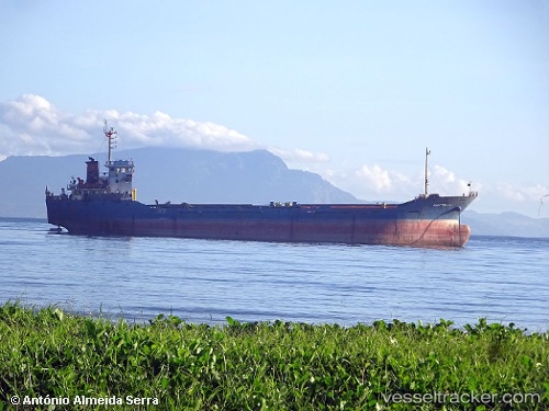
Maritime 19
Current StatusWhere is the vessel?
Maritime 19 is currently in 37 nm NE of Kampung Tanjung Langsat, based on AIS data received about 15h ago.
Latest AIS update:
Current position: 1.90610° N, 104.45019° E (37 nm NE of Kampung Tanjung Langsat)
Average speed (last 7 days): Loading…
Average speed (last 30 days): Loading…
Vessel profile: Maritime 19 is a General Cargo Ship with dimensions 16m x 92m.
This page combines live AIS, route history, probable destination signals, nearby traffic, and port activity for practical vessel monitoring.
The current position of vessel Maritime 19 is 1.90610 lat / 104.45019 lng. Updated: 2026-05-21 05:26:18 UTCNearest reference points:
- 47 nm NE of PENGERANG
- 52 nm NE of PENGERANG
- 45 nm NE of PENGERANG
Details:
Live Vessel Maritime 19 Analytics (details, animations, etc.)
Recent AIS points (UTC):
2026-05-21 02:32:10 UTC · 1.50507, 104.48066 · SOG 9.1 kn · COG 356°2026-05-21 03:57:16 UTC · 1.70622, 104.46572 · SOG 7.9 kn · COG 358°
2026-05-21 04:15:41 UTC · 1.74794, 104.46348 · SOG 8.2 kn · COG 356°
2026-05-21 05:26:18 UTC · 1.90610, 104.45019 · SOG 7.7 kn · COG 356°