 vesseltracker.com
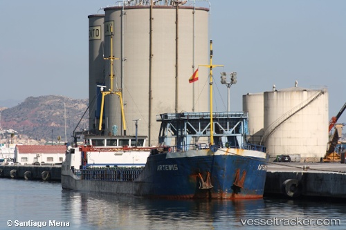
 GERDA S
Current Status
Where is the vessel?
GERDA S is currently in Near Burgas, based on AIS data received less than 1h ago.
Latest AIS update:
Current position: 42.47852° N, 27.44921° E (Near Burgas)
Average speed (last 7 days): Loading…
Average speed (last 30 days): Loading…
Vessel profile: GERDA S is a General Cargo Ship with dimensions 79m x 79m.
This page combines live AIS, route history, probable destination signals, nearby traffic, and port activity for practical vessel monitoring.
The current position of vessel GERDA S is 42.47852 lat / 27.44921 lng. Updated: 2026-05-14 21:36:58 UTCNearest reference points:
- Near Beloslav
- Near Ignatievo
- Near Varna
Currently sailing under the flag of Vanuatu ![]()
GERDA S built in 1984 year
Deadweight:
1498 tDetails:
Live Vessel GERDA S Analytics (details, animations, etc.)
Recent AIS points (UTC):
2026-05-14 18:21:51 UTC · 42.47848, 27.44919 · SOG 0 kn · COG 19°2026-05-14 19:39:54 UTC · 42.47848, 27.44921 · SOG 0 kn · COG 19°
2026-05-14 19:48:51 UTC · 42.47850, 27.44921 · SOG 0 kn · COG 19°
2026-05-14 21:36:58 UTC · 42.47852, 27.44921 · SOG 0 kn · COG 19°