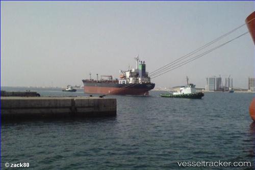
 NEREIDA
Current Status
Where is the vessel?
NEREIDA is currently in Near KHORFAKKAN, based on AIS data received about 14h ago.
Latest AIS update:
Current position: 25.42732° N, 56.46505° E (Near KHORFAKKAN)
Average speed (last 7 days): Loading…
Average speed (last 30 days): Loading…
Vessel profile: NEREIDA is a Tanker with dimensions m x m.
This page combines live AIS, route history, probable destination signals, nearby traffic, and port activity for practical vessel monitoring.
The current position of vessel NEREIDA is 25.42732 lat / 56.46505 lng. Updated: 2026-06-24 16:00:28 UTCNearest reference points:
- Near KHORFAKKAN
- Near Offshore Fujairah
- Near Fujairah
Currently sailing under the flag of Comoros ![]()
Details:
Live Vessel NEREIDA Analytics (details, animations, etc.)
Recent AIS points (UTC):
2026-06-24 11:35:15 UTC · 25.42701, 56.46439 · SOG 0 kn · COG -1°2026-06-24 13:35:30 UTC · 25.42719, 56.46467 · SOG 0 kn · COG -1°
2026-06-24 13:52:14 UTC · 25.42722, 56.46471 · SOG 0 kn · COG -1°
2026-06-24 16:00:28 UTC · 25.42732, 56.46505 · SOG 0 kn · COG -1°