 vesseltracker.com
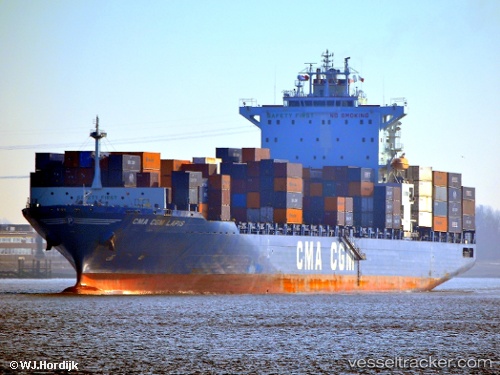
 Cma Cgm Lapis
Current Status
Where is the vessel?
Cma Cgm Lapis is currently in 11 nm NW of Bozcaada, based on AIS data received about 1h ago.
Latest AIS update:
Current position: 39.99377° N, 25.94391° E (11 nm NW of Bozcaada)
Average speed (last 7 days): Loading…
Average speed (last 30 days): Loading…
Vessel profile: Cma Cgm Lapis is a Container Ship with dimensions 258m x 32m.
This page combines live AIS, route history, probable destination signals, nearby traffic, and port activity for practical vessel monitoring.
The current position of vessel Cma Cgm Lapis is 39.99377 lat / 25.94391 lng. Updated: 2026-05-13 19:56:50 UTCNearest reference points:
- Near Bozcaada
- 10 nm W of Akcansa
- 14 nm SW of Bozcaada
Currently sailing under the flag of Liberia ![]()
Cma Cgm Lapis built in 2009 year
Deadweight:
52513 tDetails:
Live Vessel Cma Cgm Lapis Analytics (details, animations, etc.)
Recent AIS points (UTC):
2026-05-13 17:08:16 UTC · 40.31798, 26.59838 · SOG 14.9 kn · COG 225°2026-05-13 18:18:59 UTC · 40.11724, 26.36094 · SOG 15 kn · COG 215°
2026-05-13 19:16:57 UTC · 40.02463, 26.11473 · SOG 12.1 kn · COG 267°
2026-05-13 19:56:50 UTC · 39.99377, 25.94391 · SOG 12.4 kn · COG 230°