 vesseltracker.com
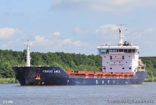
 Cengiz Amca
Current Status
Where is the vessel?
Cengiz Amca is currently in Near OUISTREHAM, based on AIS data received less than 1h ago.
Latest AIS update:
Current position: 49.34446° N, 0.19355° W (Near OUISTREHAM)
Average speed (last 7 days): Loading…
Average speed (last 30 days): Loading…
Vessel profile: Cengiz Amca is a General Cargo Ship with dimensions 132m x 18m.
This page combines live AIS, route history, probable destination signals, nearby traffic, and port activity for practical vessel monitoring.
The current position of vessel Cengiz Amca is 49.34446 lat / -0.19355 lng. Updated: 2026-04-24 11:39:23 UTCNearest reference points:
- Near Caen
- Near TROUVILLE-SUR-MER
- Near Le Havre
Currently sailing under the flag of Liberia ![]()
Details:
Live Vessel Cengiz Amca Analytics (details, animations, etc.)
Recent AIS points (UTC):
2026-04-24 07:42:23 UTC · 49.34530, -0.19523 · SOG 0 kn · COG 66°2026-04-24 09:39:23 UTC · 49.34525, -0.19519 · SOG 0.1 kn · COG 68°
2026-04-24 10:36:21 UTC · 49.34546, -0.19531 · SOG 0.1 kn · COG 74°
2026-04-24 11:39:23 UTC · 49.34446, -0.19355 · SOG 0 kn · COG 3°