 vesseltracker.com
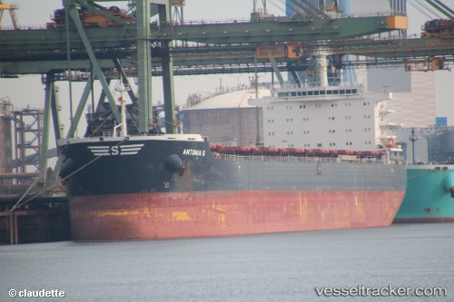
Antonia S
Current StatusWhere is the vessel?
Antonia S is currently in 290 nm W of Windermere, based on AIS data received less than 1h ago.
Latest AIS update:
Current position: 34.80645° S, 24.27621° W (290 nm W of Windermere)
Average speed (last 7 days): Loading…
Average speed (last 30 days): Loading…
Vessel profile: Antonia S is a Bulk Carrier with dimensions 32m x 229m.
This page combines live AIS, route history, probable destination signals, nearby traffic, and port activity for practical vessel monitoring.
The current position of vessel Antonia S is -34.80645 lat / -24.27621 lng. Updated: 2026-04-28 21:32:07 UTCNearest reference points:
- Open sea, approx. 401 nm off the nearest listed port
- Open sea, approx. 404 nm off the nearest listed port
- Open sea, approx. 413 nm off the nearest listed port
Details:
Live Vessel Antonia S Analytics (details, animations, etc.)
Recent AIS points (UTC):
2026-04-28 16:43:18 UTC · -34.91031, -23.28057 · SOG 10.7 kn · COG 278°2026-04-28 17:45:31 UTC · -34.88408, -23.49881 · SOG 10.2 kn · COG 280°
2026-04-28 20:14:12 UTC · -34.83667, -23.99833 · SOG 10 kn · COG -1°
2026-04-28 21:32:07 UTC · -34.80645, -24.27621 · SOG 10.5 kn · COG 275°