 vesseltracker.com
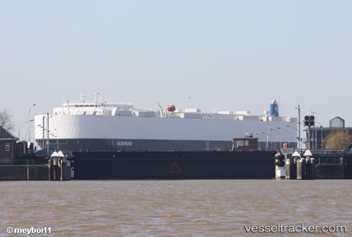
 Goodwood
Current Status
Where is the vessel?
Goodwood is currently in Near Vitoria, based on AIS data received about 2h ago.
Latest AIS update:
Current position: 20.32480° S, 40.33502° W (Near Vitoria)
Average speed (last 7 days): Loading…
Average speed (last 30 days): Loading…
Vessel profile: Goodwood is a Vehicles Carrier with dimensions 199m x 32m.
This page combines live AIS, route history, probable destination signals, nearby traffic, and port activity for practical vessel monitoring.
The current position of vessel Goodwood is -20.32480 lat / -40.33502 lng. Updated: 2026-04-10 03:26:42 UTCNearest reference points:
- Near Vitoria
- Near BAIA DE VITORIA
- Near JARDIM CAMBURI
Currently sailing under the flag of Liberia ![]()
Details:
Live Vessel Goodwood Analytics (details, animations, etc.)
Recent AIS points (UTC):
2026-04-09 22:20:49 UTC · -20.32483, -40.33503 · SOG 0 kn · COG 87°2026-04-10 00:20:46 UTC · -20.32481, -40.33504 · SOG 0 kn · COG 87°
2026-04-10 02:02:49 UTC · -20.32483, -40.33504 · SOG 0 kn · COG 87°
2026-04-10 03:26:42 UTC · -20.32480, -40.33502 · SOG 0 kn · COG 87°