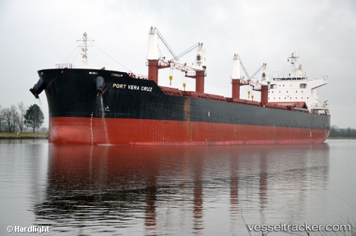
 Port Vera Cruz
Current Status
Where is the vessel?
Port Vera Cruz is currently in Near Nueva Palmira, based on AIS data received about 14h ago.
Latest AIS update:
Current position: 33.87644° S, 58.42388° W (Near Nueva Palmira)
Average speed (last 7 days): Loading…
Average speed (last 30 days): Loading…
Vessel profile: Port Vera Cruz is a Bulk Carrier with dimensions 199m x 32m.
This page combines live AIS, route history, probable destination signals, nearby traffic, and port activity for practical vessel monitoring.
The current position of vessel Port Vera Cruz is -33.87644 lat / -58.42388 lng. Updated: 2026-05-21 04:09:20 UTCNearest reference points:
- Near Avellaneda
- Near Dock Sur
- Near JUAN LACAZE
Currently sailing under the flag of Liberia ![]()
Details:
Live Vessel Port Vera Cruz Analytics (details, animations, etc.)
Recent AIS points (UTC):
2026-05-20 23:27:19 UTC · -33.87642, -58.42390 · SOG 0 kn · COG 184°2026-05-21 01:57:16 UTC · -33.87645, -58.42390 · SOG 0 kn · COG 184°
2026-05-21 02:00:17 UTC · -33.87645, -58.42389 · SOG 0 kn · COG 184°
2026-05-21 04:09:20 UTC · -33.87644, -58.42388 · SOG 0 kn · COG 184°