 vesseltracker.com
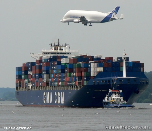
 PORTO CHELI
Current Status
Where is the vessel?
PORTO CHELI is currently in 163 nm NE of Campohermoso, based on AIS data received less than 1h ago.
Latest AIS update:
Current position: 38.15651° N, 19.74933° W (163 nm NE of Campohermoso)
Average speed (last 7 days): Loading…
Average speed (last 30 days): Loading…
Vessel profile: PORTO CHELI is a Container Ship with dimensions 40m x 300m.
This page combines live AIS, route history, probable destination signals, nearby traffic, and port activity for practical vessel monitoring.
The current position of vessel PORTO CHELI is 38.15651 lat / -19.74933 lng. Updated: 2026-04-19 08:15:45 UTCNearest reference points:
- 68 nm NE of Campohermoso
Currently sailing under the flag of Liberia ![]()
PORTO CHELI built in 2001 year
Deadweight:
79465 tDetails:
Live Vessel PORTO CHELI Analytics (details, animations, etc.)
Recent AIS points (UTC):
2026-04-19 01:31:36 UTC · 38.45925, -21.44281 · SOG 11.9 kn · COG 104°2026-04-19 03:06:25 UTC · 38.38665, -21.04912 · SOG 12.2 kn · COG 102°
2026-04-19 06:09:24 UTC · 38.25245, -20.27917 · SOG 12.4 kn · COG 101°
2026-04-19 08:15:45 UTC · 38.15651, -19.74933 · SOG 12 kn · COG 103°