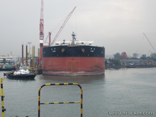
 TAMBA
TAMBA
Current Status
Where is the vessel?
TAMBA is currently in Near Malacca, based on AIS data received about 15h ago.
Latest AIS update:
Current position: 2.16889° N, 102.16458° E (Near Malacca)
Average speed (last 7 days): Loading…
Average speed (last 30 days): Loading…
Vessel profile: TAMBA is a Crude Oil Tanker with dimensions 333m x 60m.
This page combines live AIS, route history, probable destination signals, nearby traffic, and port activity for practical vessel monitoring.
The current position of vessel TAMBA is 2.16889 lat / 102.16458 lng. Updated: 2026-05-20 03:42:05 UTCNearest reference points:
- Near Malacca
- Near SUNGAI UDANG
- Near MELAKA
Currently sailing under the flag of Liberia ![]()
TAMBA built in 2009 year
Deadweight:
302107 tDetails:
Live Vessel TAMBA Analytics (details, animations, etc.)
Recent AIS points (UTC):
2026-05-20 00:08:38 UTC · 2.17569, 102.15202 · SOG 0.1 kn · COG 336°2026-05-20 02:07:27 UTC · 2.17638, 102.15360 · SOG 0 kn · COG 301°
2026-05-20 02:19:26 UTC · 2.17640, 102.15205 · SOG 1.6 kn · COG 236°
2026-05-20 03:42:05 UTC · 2.16889, 102.16458 · SOG 0.4 kn · COG 302°