 vesseltracker.com
 NINA A
Current Status
Where is the vessel?
NINA A is currently in Near Yakuplu, based on AIS data received about 1h ago.
Latest AIS update:
Current position: 40.93683° N, 28.61703° E (Near Yakuplu)
Average speed (last 7 days): Loading…
Average speed (last 30 days): Loading…
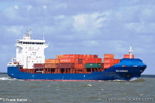
Vessel profile: NINA A is a Container Ship with dimensions 129m x 21m.
This page combines live AIS, route history, probable destination signals, nearby traffic, and port activity for practical vessel monitoring.
The current position of vessel NINA A is 40.93683 lat / 28.61703 lng. Updated: 2026-05-14 19:48:37 UTCNearest reference points:
- Near Ambarli
- Near Gürpinar
- Near Küçükçekmece
Currently sailing under the flag of Liberia ![]()
NINA A built in 2008 year
Deadweight:
8137 tDetails:
Live Vessel NINA A Analytics (details, animations, etc.)
Recent AIS points (UTC):
2026-05-14 16:06:23 UTC · 40.96110, 28.67672 · SOG 0 kn · COG 355°2026-05-14 18:24:05 UTC · 40.93663, 28.61817 · SOG 1.9 kn · COG 328°
2026-05-14 19:39:56 UTC · 40.93696, 28.61652 · SOG 0 kn · COG 23°
2026-05-14 19:48:37 UTC · 40.93683, 28.61703 · SOG 0.2 kn · COG 6°