 vesseltracker.com
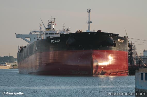
 PETALIDI
Current Status
Where is the vessel?
PETALIDI is currently in 32 nm E of Charlotteville, based on AIS data received less than 1h ago.
Latest AIS update:
Current position: 11.34835° N, 60.00370° W (32 nm E of Charlotteville)
Average speed (last 7 days): Loading…
Average speed (last 30 days): Loading…
Vessel profile: PETALIDI is a Crude Oil Tanker with dimensions 48m x 274m.
This page combines live AIS, route history, probable destination signals, nearby traffic, and port activity for practical vessel monitoring.
The current position of vessel PETALIDI is 11.34835 lat / -60.00370 lng. Updated: 2026-04-27 16:37:45 UTCNearest reference points:
- 16 nm E of Galeota Point
- Near Caroni
- Near CARENAGE
Currently sailing under the flag of Liberia ![]()
PETALIDI built in 2012 year
Deadweight:
158532 tDetails:
Live Vessel PETALIDI Analytics (details, animations, etc.)
Recent AIS points (UTC):
2026-04-27 12:01:17 UTC · 10.52678, -59.38190 · SOG 13 kn · COG 323°2026-04-27 14:01:09 UTC · 10.87988, -59.64959 · SOG 13.2 kn · COG 324°
2026-04-27 16:26:27 UTC · 11.31473, -59.97836 · SOG 13.2 kn · COG 322°
2026-04-27 16:37:45 UTC · 11.34835, -60.00370 · SOG 13.2 kn · COG 322°