 vesseltracker.com
 CAIPIRINHA
Current Status
Where is the vessel?
CAIPIRINHA is currently in 20 nm S of Cape Agulhas, based on AIS data received about 1h ago.
Latest AIS update:
Current position: 35.17083° S, 20.02569° E (20 nm S of Cape Agulhas)
Average speed (last 7 days): Loading…
Average speed (last 30 days): Loading…
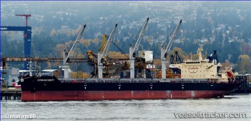
Vessel profile: CAIPIRINHA is a Bulk Carrier with dimensions 32m x 180m.
This page combines live AIS, route history, probable destination signals, nearby traffic, and port activity for practical vessel monitoring.
The current position of vessel CAIPIRINHA is -35.17083 lat / 20.02569 lng. Updated: 2026-04-19 16:08:13 UTCNearest reference points:
- 15 nm SE of Moorreesburg
- Near Mitchells Plain
- 18 nm SW of Cape Of Good Hope
Currently sailing under the flag of Liberia ![]()
CAIPIRINHA built in 2015 year
Deadweight:
38668 tDetails:
Live Vessel CAIPIRINHA Analytics (details, animations, etc.)
Recent AIS points (UTC):
2026-04-19 13:56:27 UTC · -35.09613, 19.51818 · SOG 11.6 kn · COG 112°2026-04-19 14:00:24 UTC · -35.10015, 19.53335 · SOG 11.8 kn · COG 113°
2026-04-19 16:03:03 UTC · -35.17078, 20.00584 · SOG 11.6 kn · COG 90°
2026-04-19 16:08:13 UTC · -35.17083, 20.02569 · SOG 11.2 kn · COG 90°