 K ONSET
Current Status
Where is the vessel?
K ONSET is currently in Near Damietta, based on AIS data received about 14h ago.
Latest AIS update:
Current position: 31.63370° N, 31.75400° E (Near Damietta)
Average speed (last 7 days): Loading…
Average speed (last 30 days): Loading…
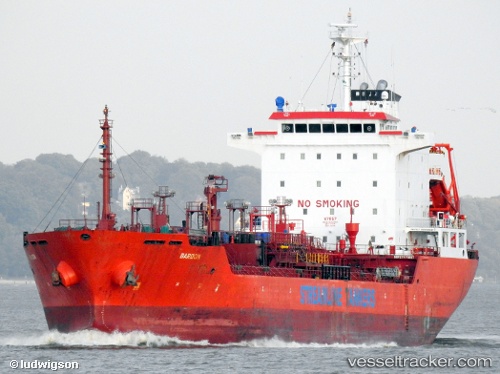
Vessel profile: K ONSET is a Chemical/Oil Products Tanker with dimensions 127m x 20m.
This page combines live AIS, route history, probable destination signals, nearby traffic, and port activity for practical vessel monitoring.
The current position of vessel K ONSET is 31.63370 lat / 31.75400 lng. Updated: 2026-05-25 01:39:44 UTCNearest reference points:
- Near Damietta
- 21 nm N of Port Said
- 15 nm N of Port Said
Currently sailing under the flag of Liberia ![]()
K ONSET built in 2006 year
Deadweight:
12902 tDetails:
Live Vessel K ONSET Analytics (details, animations, etc.)
Recent AIS points (UTC):
2026-05-24 22:06:44 UTC · 31.63360, 31.75392 · SOG 0 kn · COG 263°2026-05-24 23:21:44 UTC · 31.63350, 31.75397 · SOG 0 kn · COG 272°
2026-05-25 01:15:44 UTC · 31.63365, 31.75400 · SOG 0 kn · COG 264°
2026-05-25 01:39:44 UTC · 31.63370, 31.75400 · SOG 0 kn · COG 260°