 vesseltracker.com
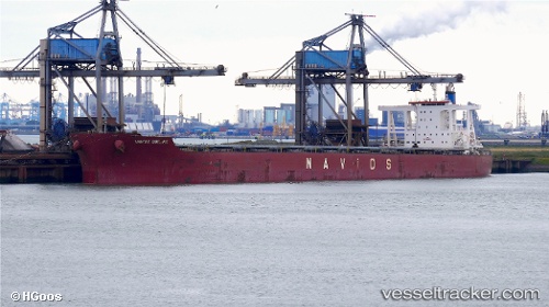
 PAROSHIP
Current Status
Where is the vessel?
PAROSHIP is currently in 29 nm NE of BIZERTE, based on AIS data received about 2h ago.
Latest AIS update:
Current position: 37.54676° N, 10.35061° E (29 nm NE of BIZERTE)
Average speed (last 7 days): Loading…
Average speed (last 30 days): Loading…
Vessel profile: PAROSHIP is a Bulk Carrier with dimensions m x m.
This page combines live AIS, route history, probable destination signals, nearby traffic, and port activity for practical vessel monitoring.
The current position of vessel PAROSHIP is 37.54676 lat / 10.35061 lng. Updated: 2026-03-30 09:56:47 UTCNearest reference points:
- 32 nm N of Qulaybiyah
- Near Le Kram
- 13 nm N of Qulaybiyah
Currently sailing under the flag of Liberia ![]()
Details:
Live Vessel PAROSHIP Analytics (details, animations, etc.)
Recent AIS points (UTC):
2026-03-30 03:35:57 UTC · 37.73868, 8.87574 · SOG 11 kn · COG 95°2026-03-30 05:21:48 UTC · 37.69438, 9.26693 · SOG 10.7 kn · COG 103°
2026-03-30 07:56:57 UTC · 37.59870, 9.86486 · SOG 11.7 kn · COG 107°
2026-03-30 09:56:47 UTC · 37.54676, 10.35061 · SOG 11.9 kn · COG 99°