 vesseltracker.com
 The Loop
Current Status
Where is the vessel?
The Loop is currently in Near Kumport, based on AIS data received less than 1h ago.
Latest AIS update:
Current position: 40.94802° N, 28.78842° E (Near Kumport)
Average speed (last 7 days): Loading…
Average speed (last 30 days): Loading…
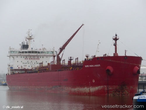
Vessel profile: The Loop is a Chemical Tanker with dimensions 183m x 27m.
This page combines live AIS, route history, probable destination signals, nearby traffic, and port activity for practical vessel monitoring.
The current position of vessel The Loop is 40.94802 lat / 28.78842 lng. Updated: 2026-05-15 21:51:38 UTCNearest reference points:
- Near Kumport
- Near Küçükçekmece
- Near Ambarli
Currently sailing under the flag of Liberia ![]()
The Loop built in 2007 year
Deadweight:
37145 tDetails:
Live Vessel The Loop Analytics (details, animations, etc.)
Recent AIS points (UTC):
2026-05-15 18:15:59 UTC · 40.94878, 28.78998 · SOG 0.1 kn · COG 150°2026-05-15 19:21:37 UTC · 40.94827, 28.78913 · SOG 0 kn · COG 118°
2026-05-15 19:27:38 UTC · 40.94818, 28.78909 · SOG 0 kn · COG 113°
2026-05-15 21:51:38 UTC · 40.94802, 28.78842 · SOG 0.1 kn · COG 101°