 LM ARES
Current Status
Where is the vessel?
LM ARES is currently in Near St. John’S, based on AIS data received about 15h ago.
Latest AIS update:
Current position: 17.15740° N, 61.91757° W (Near St. John’S)
Average speed (last 7 days): Loading…
Average speed (last 30 days): Loading…
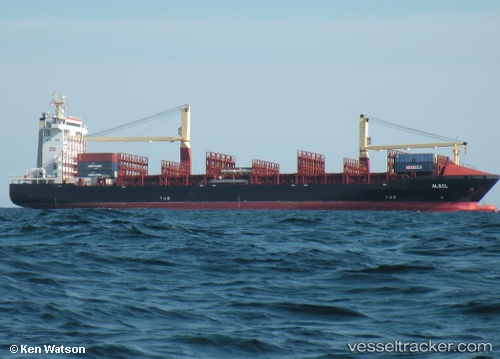
Vessel profile: LM ARES is a Container Ship with dimensions m x m.
This page combines live AIS, route history, probable destination signals, nearby traffic, and port activity for practical vessel monitoring.
The current position of vessel LM ARES is 17.15740 lat / -61.91757 lng. Updated: 2026-06-23 11:27:49 UTCNearest reference points:
- Near Saint John's
- Near ANTIGUA
- Near Pointe A Pitre
Currently sailing under the flag of Liberia ![]()
Details:
Live Vessel LM ARES Analytics (details, animations, etc.)
Recent AIS points (UTC):
2026-06-23 08:09:43 UTC · 17.15733, -61.91753 · SOG 0.2 kn · COG 71°2026-06-23 09:39:49 UTC · 17.15808, -61.91774 · SOG 0.1 kn · COG 93°
2026-06-23 10:48:35 UTC · 17.15816, -61.91773 · SOG 0.3 kn · COG 97°
2026-06-23 11:27:49 UTC · 17.15740, -61.91757 · SOG 0.3 kn · COG 70°