 vesseltracker.com
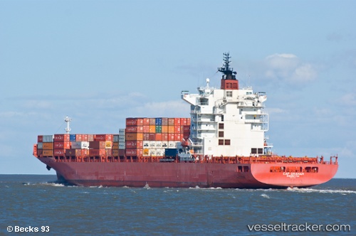
 NORTHERN GUARD
Current Status
Where is the vessel?
NORTHERN GUARD is currently in 27 nm W of Dehiwala, based on AIS data received less than 1h ago.
Latest AIS update:
Current position: 6.77122° N, 79.39842° E (27 nm W of Dehiwala)
Average speed (last 7 days): Loading…
Average speed (last 30 days): Loading…
Vessel profile: NORTHERN GUARD is a Container Ship with dimensions m x m.
This page combines live AIS, route history, probable destination signals, nearby traffic, and port activity for practical vessel monitoring.
The current position of vessel NORTHERN GUARD is 6.77122 lat / 79.39842 lng. Updated: 2026-05-16 14:12:35 UTCNearest reference points:
- 67 nm SW of Moratuwa
- 19 nm SW of Bataduwa
- 82 nm W of Moratuwa
Currently sailing under the flag of Liberia ![]()
Details:
Live Vessel NORTHERN GUARD Analytics (details, animations, etc.)
Recent AIS points (UTC):
2026-05-16 10:34:56 UTC · 6.87842, 79.56137 · SOG 1.3 kn · COG 300°2026-05-16 11:50:28 UTC · 6.79583, 79.43045 · SOG 9.1 kn · COG 244°
2026-05-16 13:59:36 UTC · 6.76993, 79.39408 · SOG 1.3 kn · COG 305°
2026-05-16 14:12:35 UTC · 6.77122, 79.39842 · SOG 1.3 kn · COG 311°