 vesseltracker.com
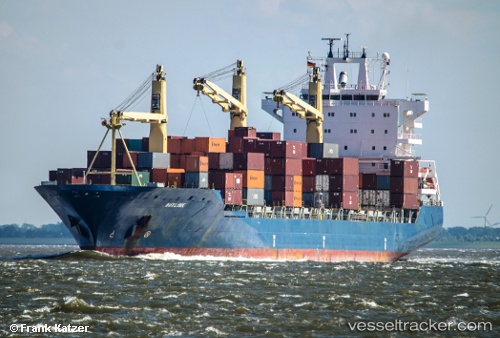
Buxlink
Current StatusWhere is the vessel?
Buxlink is currently in 15 nm E of Marsaxlokk, based on AIS data received about 1h ago.
Latest AIS update:
Current position: 35.71870° N, 14.83846° E (15 nm E of Marsaxlokk)
Average speed (last 7 days): Loading…
Average speed (last 30 days): Loading…
Vessel profile: Buxlink is a Container Ship with dimensions 30m x 208m.
This page combines live AIS, route history, probable destination signals, nearby traffic, and port activity for practical vessel monitoring.
The current position of vessel Buxlink is 35.71870 lat / 14.83846 lng. Updated: 2026-05-15 23:48:15 UTCNearest reference points:
- 13 nm E of Il-Kappara
- 18 nm E of Il-Kappara
- Near Xghajra
Details:
Live Vessel Buxlink Analytics (details, animations, etc.)
Recent AIS points (UTC):
2026-05-15 19:52:57 UTC · 35.68690, 14.83223 · SOG 0.3 kn · COG 91°2026-05-15 21:45:58 UTC · 35.69526, 14.84018 · SOG 0.1 kn · COG 71°
2026-05-15 22:14:43 UTC · 35.69844, 14.84036 · SOG 0.8 kn · COG 83°
2026-05-15 23:48:15 UTC · 35.71870, 14.83846 · SOG 0.2 kn · COG 69°