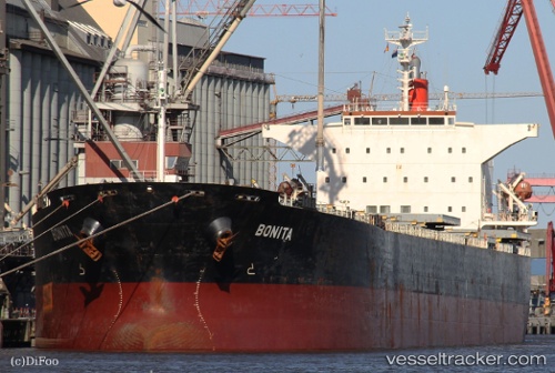
.
Vessel photo of Bonita (IMO 9231286) vesseltracker.com

LR flag Bonita

Vessel type: Bulk Carrier | IMO: 9231286 | MMSI: MMSI: 636091840
Call sign: A8TM5 | Dimensions: 225 m x 32 m
Current Status

Where is the vessel?

Bonita is currently in Open sea, approx. 426 nm off the nearest listed port, based on AIS data received about 170d ago.

Latest AIS update:

Current position: 79.93662° N, 149.38495° W (Open sea, approx. 426 nm off the nearest listed port)

Average speed (last 7 days): Loading…

Average speed (last 30 days): Loading…

Vessel profile: Bonita is a Bulk Carrier with dimensions 225m x 32m.

This page combines live AIS, route history, probable destination signals, nearby traffic, and port activity for practical vessel monitoring.

The current position of vessel Bonita is 79.93662 lat / -149.38495 lng. Updated: 2025-11-02 22:46:51 UTC
Nearest reference points:
  • Open sea, approx. 426 nm off the nearest listed port
  • Open sea, approx. 439 nm off the nearest listed port
  • Open sea, approx. 416 nm off the nearest listed port

Currently sailing under the flag of Liberia LR flag

Bonita built in 2001 year

Deadweight:
76623 t

Details:

Live Vessel Bonita Analytics (details, animations, etc.)


Recent AIS points (UTC):
2025-11-02 22:46:51 UTC · 79.93662, -149.38495 · SOG 45.5 kn · COG 235°

Track of the vessel in the last 60 days


UTC: --
Start: -- Track timeline (UTC) End: --
Encountered: --


Link to the map:


Find another ship

Bonita (636091840) last ports (portcalls and passsages)

Vung Tau | 2025-03-04 11:46:31
Incheon | 2022-10-03 13:35:18
Incheon | 2022-09-29 13:24:58
Incheon | 2022-09-25 10:50:37
Bur Ibrahim | 2022-08-26 19:02:17
Kalamai | 2022-08-21 14:06:50
Canakkale | 2022-08-20 07:32:15
Uskudar | 2022-08-18 07:08:44
Strait Of Gibraltar | 2022-01-05 18:55:37
Cristobal | 2021-12-19 21:56:50
Balboa | 2021-12-19 12:40:01
Panama | 2021-12-19 11:50:09
Panama | 2021-12-05 12:15:07