 vesseltracker.com
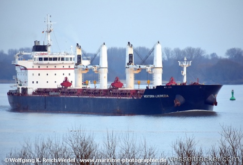
 LANCASTER STRAIT
Current Status
Where is the vessel?
LANCASTER STRAIT is currently in 11 nm E of Belfast, based on AIS data received about 162d ago.
Latest AIS update:
Current position: 55.05320° N, 5.60650° W (11 nm E of Belfast)
Average speed (last 7 days): Loading…
Average speed (last 30 days): Loading…
Vessel profile: LANCASTER STRAIT is a Bulk Carrier with dimensions 29m x 187m.
This page combines live AIS, route history, probable destination signals, nearby traffic, and port activity for practical vessel monitoring.
The current position of vessel LANCASTER STRAIT is 55.05320 lat / -5.60650 lng. Updated: 2025-11-01 06:15:23 UTCNearest reference points:
- Near Belfast
- Near Southend
- Near Campbeltown
Currently sailing under the flag of Liberia ![]()
LANCASTER STRAIT built in 2013 year
Deadweight:
37405 tDetails:
Live Vessel LANCASTER STRAIT Analytics (details, animations, etc.)
Recent AIS points (UTC):
2025-11-01 06:15:23 UTC · 55.05320, -5.60650 · SOG 11 kn · COG 325°