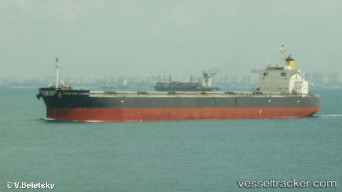
 CONTESSA
Current Status
Where is the vessel?
CONTESSA is currently in 134 nm NE of Fortaleza, based on AIS data received about 14h ago.
Latest AIS update:
Current position: 2.25460° S, 36.81470° W (134 nm NE of Fortaleza)
Average speed (last 7 days): Loading…
Average speed (last 30 days): Loading…
Vessel profile: CONTESSA is a Cargo with dimensions m x m.
This page combines live AIS, route history, probable destination signals, nearby traffic, and port activity for practical vessel monitoring.
The current position of vessel CONTESSA is -2.25460 lat / -36.81470 lng. Updated: 2026-05-20 09:21:13 UTCNearest reference points:
- 169 nm N of Pecém Pt/São Gonçalo do Amarante
- 28 nm N of Pecém Pt/São Gonçalo do Amarante
- 141 nm N of Itarema
Currently sailing under the flag of Liberia ![]()
Details:
Live Vessel CONTESSA Analytics (details, animations, etc.)
Recent AIS points (UTC):
2026-05-20 05:56:12 UTC · -2.01367, -37.19918 · SOG 8.2 kn · COG 118°2026-05-20 07:03:03 UTC · -2.08981, -37.07113 · SOG 8.2 kn · COG 118°
2026-05-20 07:52:22 UTC · -2.14460, -36.97578 · SOG 7.9 kn · COG 124°
2026-05-20 09:21:13 UTC · -2.25460, -36.81470 · SOG 7.9 kn · COG 118°