 vesseltracker.com
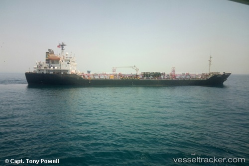
 MARIYA
Current Status
Where is the vessel?
MARIYA is currently in 12 nm NW of Bonny, based on AIS data received about 1h ago.
Latest AIS update:
Current position: 4.55532° N, 6.99956° E (12 nm NW of Bonny)
Average speed (last 7 days): Loading…
Average speed (last 30 days): Loading…
Vessel profile: MARIYA is a Oil/Chemical Tanker with dimensions m x m.
This page combines live AIS, route history, probable destination signals, nearby traffic, and port activity for practical vessel monitoring.
The current position of vessel MARIYA is 4.55532 lat / 6.99956 lng. Updated: 2026-04-12 15:32:29 UTCNearest reference points:
- Near Bonny
- Near Onne
- Near Port Harcourt
Currently sailing under the flag of Nigeria ![]()
Details:
Live Vessel MARIYA Analytics (details, animations, etc.)
Recent AIS points (UTC):
2026-04-12 10:45:58 UTC · 4.55623, 6.98924 · SOG 0.1 kn · COG 183°2026-04-12 11:52:58 UTC · 4.55615, 6.98940 · SOG 0.1 kn · COG 196°
2026-04-12 13:28:09 UTC · 4.55616, 6.98895 · SOG 0.1 kn · COG 151°
2026-04-12 15:32:29 UTC · 4.55532, 6.99956 · SOG 0.2 kn · COG 1°