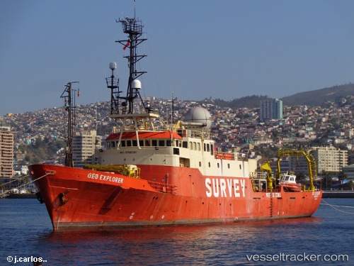
.
Vessel photo of Geo Explorer (IMO 6700391) vesseltracker.com

Geo Explorer

Vessel type: Offshore Support Vessel | IMO: 6700391 | MMSI: MMSI: 341632000
Call sign: V4YI | Dimensions: 12 m x 74 m
Current Status

Where is the vessel?

Geo Explorer is currently in 41 nm NE of PENGERANG, based on AIS data received about 1209d ago.

Latest AIS update:

Current position: 1.82183° N, 104.63799° E (41 nm NE of PENGERANG)

Average speed (last 7 days): Loading…

Average speed (last 30 days): Loading…

Vessel profile: Geo Explorer is a Offshore Support Vessel with dimensions 12m x 74m.

This page combines live AIS, route history, probable destination signals, nearby traffic, and port activity for practical vessel monitoring.

The current position of vessel Geo Explorer is 1.82183 lat / 104.63799 lng. Updated: 2023-01-04 03:57:52 UTC
Nearest reference points:
  • 45 nm NE of PENGERANG
  • 47 nm NE of PENGERANG
  • 51 nm NE of PENGERANG
Details:

Live Vessel Geo Explorer Analytics (details, animations, etc.)


Recent AIS points (UTC):
2023-01-04 03:57:52 UTC · 1.82183, 104.63799 · SOG 0.1 kn · COG 338°

Track of the vessel in the last 60 days


UTC: --
Start: -- Track timeline (UTC) End: --
Encountered: --


Link to the map:


Find another ship

Geo_Explorer (341632000) last ports (portcalls and passsages)

Sharjah | 2022-11-02 14:04:34
Sharjah | 2022-10-29 13:09:49
Sharjah | 2022-10-25 10:29:12
Sharjah | 2022-10-21 07:51:26
Sharjah | 2022-10-17 07:06:14