 vesseltracker.com
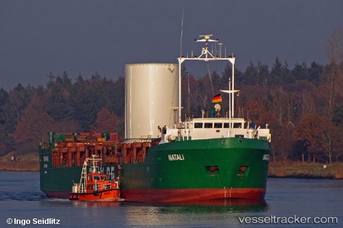
 Natali
Current Status
Where is the vessel?
Natali is currently in Near Nemrut Bay, based on AIS data received about 2h ago.
Latest AIS update:
Current position: 38.81220° N, 26.77753° E (Near Nemrut Bay)
Average speed (last 7 days): Loading…
Average speed (last 30 days): Loading…
Vessel profile: Natali is a General Cargo Ship with dimensions 91m x 14m.
This page combines live AIS, route history, probable destination signals, nearby traffic, and port activity for practical vessel monitoring.
The current position of vessel Natali is 38.81220 lat / 26.77753 lng. Updated: 2026-05-14 19:48:33 UTCNearest reference points:
- Near Nemrut Bay
- Near Aliaga
- Near NEMRUT
Currently sailing under the flag of Togo ![]()
Natali built in 1983 year
Deadweight:
2352 tDetails:
Live Vessel Natali Analytics (details, animations, etc.)
Recent AIS points (UTC):
2026-05-14 13:08:15 UTC · 38.76315, 26.91680 · SOG 0 kn · COG 306°2026-05-14 19:31:02 UTC · 38.80112, 26.82010 · SOG 6.7 kn · COG 285°
2026-05-14 19:48:33 UTC · 38.81220, 26.77753 · SOG 7.2 kn · COG 289°
2026-05-14 19:48:33 UTC · 38.81220, 26.77753 · SOG 7.2 kn · COG 289°