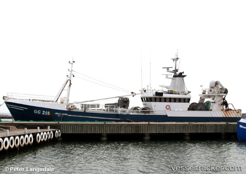
Westfjord
Current StatusWhere is the vessel?
Westfjord is currently in 30 nm W of Uusikaupunki, based on AIS data received about 14h ago.
Latest AIS update:
Current position: 60.91761° N, 20.38786° E (30 nm W of Uusikaupunki)
Average speed (last 7 days): Loading…
Average speed (last 30 days): Loading…
Vessel profile: Westfjord is a Fishing Vessel with dimensions 8m x 40m.
This page combines live AIS, route history, probable destination signals, nearby traffic, and port activity for practical vessel monitoring.
The current position of vessel Westfjord is 60.91761 lat / 20.38786 lng. Updated: 2026-05-20 15:56:19 UTCNearest reference points:
- Near Finström
- Near Maarianhamina (Mariehamn)
- Near MARIEHAMN
Details:
Live Vessel Westfjord Analytics (details, animations, etc.)
Recent AIS points (UTC):
2026-05-20 11:37:18 UTC · 60.88092, 20.40496 · SOG 2.5 kn · COG 119°2026-05-20 13:02:28 UTC · 60.85073, 20.49707 · SOG 2.6 kn · COG 196°
2026-05-20 13:50:18 UTC · 60.86098, 20.43928 · SOG 2.7 kn · COG 306°
2026-05-20 15:56:19 UTC · 60.91761, 20.38786 · SOG 2.4 kn · COG 82°