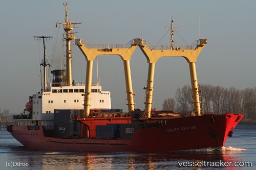
Amr R
Current StatusWhere is the vessel?
Amr R is currently in Near Annaba, based on AIS data received about 15h ago.
Latest AIS update:
Current position: 36.87762° N, 7.77001° E (Near Annaba)
Average speed (last 7 days): Loading…
Average speed (last 30 days): Loading…
Vessel profile: Amr R is a Multi Purpose Carrier with dimensions 17m x 130m.
This page combines live AIS, route history, probable destination signals, nearby traffic, and port activity for practical vessel monitoring.
The current position of vessel Amr R is 36.87762 lat / 7.77001 lng. Updated: 2026-06-17 05:35:06 UTCNearest reference points:
- Near Annaba
- Near Skikid
- 35 nm S of Setubal
Details:
Live Vessel Amr R Analytics (details, animations, etc.)
Recent AIS points (UTC):
2026-06-17 02:26:09 UTC · 36.87668, 7.76860 · SOG 0 kn · COG 242°2026-06-17 03:26:05 UTC · 36.87664, 7.76860 · SOG 0 kn · COG 242°
2026-06-17 04:53:06 UTC · 36.87663, 7.76858 · SOG 0 kn · COG 241°
2026-06-17 05:35:06 UTC · 36.87762, 7.77001 · SOG 0.6 kn · COG 262°