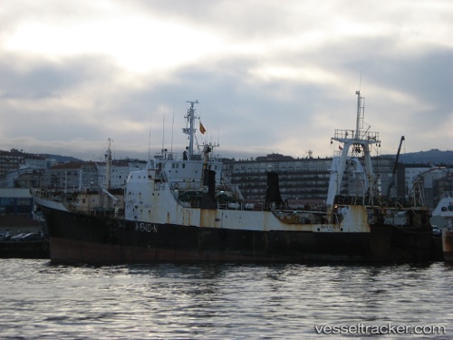
Santa Mafalda
Current StatusWhere is the vessel?
Santa Mafalda is currently in Near Gafanha da Nazaré, based on AIS data received about 9d ago.
Latest AIS update:
Current position: 40.64624° N, 8.69783° W (Near Gafanha da Nazaré)
Average speed (last 7 days): Loading…
Average speed (last 30 days): Loading…
Vessel profile: Santa Mafalda is a Fishing Vessel with dimensions 11m x 80m.
This page combines live AIS, route history, probable destination signals, nearby traffic, and port activity for practical vessel monitoring.
The current position of vessel Santa Mafalda is 40.64624 lat / -8.69783 lng. Updated: 2026-05-11 16:20:45 UTCNearest reference points:
- Near Gafanha da Nazaré
- Near Matosinhos
- Near Figuera Da Foz
Details:
Live Vessel Santa Mafalda Analytics (details, animations, etc.)
Recent AIS points (UTC):
2026-05-11 16:12:36 UTC · 40.64618, -8.69784 · SOG 0 kn · COG 359°2026-05-11 16:20:45 UTC · 40.64624, -8.69783 · SOG 0 kn · COG -1°
2026-05-11 16:20:45 UTC · 40.64624, -8.69783 · SOG 0 kn · COG -1°
2026-05-11 16:20:45 UTC · 40.64624, -8.69783 · SOG 0 kn · COG -1°