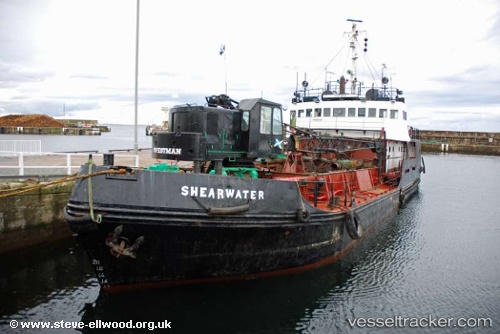
 SHEARWATER
Current Status
Where is the vessel?
SHEARWATER is currently in Near Granton, based on AIS data received about 726d ago.
Latest AIS update:
Current position: 55.98205° N, 3.22294° W (Near Granton)
Average speed (last 7 days): Loading…
Average speed (last 30 days): Loading…
Vessel profile: SHEARWATER is a Dredger with dimensions 38m x 9m.
This page combines live AIS, route history, probable destination signals, nearby traffic, and port activity for practical vessel monitoring.
The current position of vessel SHEARWATER is 55.98205 lat / -3.22294 lng. Updated: 2024-05-24 10:34:36 UTCNearest reference points:
- Near Leith
- Near BROUGHTY FERRY
- Near North Berwick
Currently sailing under the flag of Comoros ![]()
SHEARWATER built in 1968 year
Deadweight:
305 tDetails:
Live Vessel SHEARWATER Analytics (details, animations, etc.)
Recent AIS points (UTC):
2024-05-24 10:34:36 UTC · 55.98205, -3.22294 · SOG 0.1 kn · COG -1°