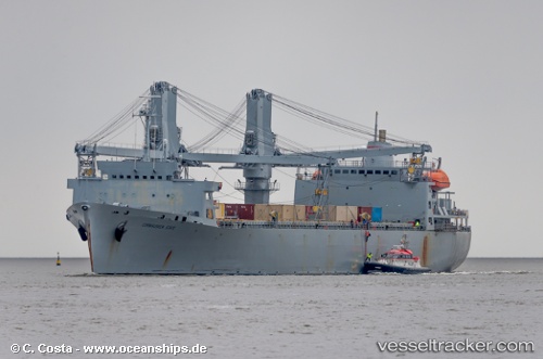
Cornhusker State
Current StatusWhere is the vessel?
Cornhusker State is currently in 16 nm E of Il-Kappara, based on AIS data received about 1d ago.
Latest AIS update:
Current position: 35.87039° N, 14.89089° E (16 nm E of Il-Kappara)
Average speed (last 7 days): Loading…
Average speed (last 30 days): Loading…
Vessel profile: Cornhusker State is a Crane Ship with dimensions 22m x 186m.
This page combines live AIS, route history, probable destination signals, nearby traffic, and port activity for practical vessel monitoring.
The current position of vessel Cornhusker State is 35.87039 lat / 14.89089 lng. Updated: 2026-05-22 06:39:14 UTCNearest reference points:
- 13 nm E of Il-Kappara
- 18 nm E of Il-Kappara
- Near Xghajra
Details:
Live Vessel Cornhusker State Analytics (details, animations, etc.)
Recent AIS points (UTC):
2026-05-22 06:39:14 UTC · 35.87039, 14.89089 · SOG 15.9 kn · COG 95°2026-05-22 06:39:14 UTC · 35.87039, 14.89089 · SOG 15.9 kn · COG 95°
2026-05-22 06:39:14 UTC · 35.87039, 14.89089 · SOG 15.9 kn · COG 95°
2026-05-22 06:39:14 UTC · 35.87039, 14.89089 · SOG 15.9 kn · COG 95°