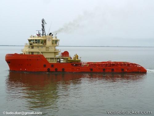
 BUSHBUCK
Current Status
Where is the vessel?
BUSHBUCK is currently in 64 nm SE of Arraial do Cabo, based on AIS data received about 14h ago.
Latest AIS update:
Current position: 23.55833° S, 41.04833° W (64 nm SE of Arraial do Cabo)
Average speed (last 7 days): Loading…
Average speed (last 30 days): Loading…
Vessel profile: BUSHBUCK is a Diving ops with dimensions m x m.
This page combines live AIS, route history, probable destination signals, nearby traffic, and port activity for practical vessel monitoring.
The current position of vessel BUSHBUCK is -23.55833 lat / -41.04833 lng. Updated: 2026-05-20 10:55:56 UTCNearest reference points:
- 47 nm E of Arraial do Cabo
- Near Fluminense FPSO
- 24 nm SE of Carapebus
Details:
Live Vessel BUSHBUCK Analytics (details, animations, etc.)
Recent AIS points (UTC):
2026-05-20 06:58:56 UTC · -23.53833, -41.06167 · SOG 3 kn · COG -1°2026-05-20 07:55:54 UTC · -23.51667, -41.01167 · SOG 2 kn · COG -1°
2026-05-20 09:22:58 UTC · -23.49833, -41.01333 · SOG 2 kn · COG -1°
2026-05-20 10:55:56 UTC · -23.55833, -41.04833 · SOG 2 kn · COG -1°