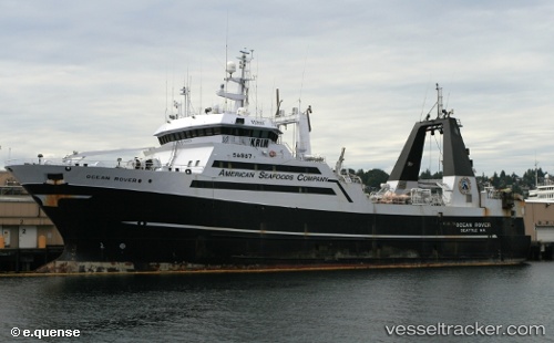
 Ocean Rover
Current Status
Where is the vessel?
Ocean Rover is currently in Near Bellingham, based on AIS data received about 14h ago.
Latest AIS update:
Current position: 48.75945° N, 122.50970° W (Near Bellingham)
Average speed (last 7 days): Loading…
Average speed (last 30 days): Loading…
Vessel profile: Ocean Rover is a Fishing Vessel with dimensions 64m x 18m.
This page combines live AIS, route history, probable destination signals, nearby traffic, and port activity for practical vessel monitoring.
The current position of vessel Ocean Rover is 48.75945 lat / -122.50970 lng. Updated: 2026-05-21 07:36:38 UTCNearest reference points:
- Near Bellingham
- Near Anacortes
- Near ORCAS
Currently sailing under the flag of USA ![]()
Ocean Rover built in 1973 year
Deadweight:
1859 tDetails:
Live Vessel Ocean Rover Analytics (details, animations, etc.)
Recent AIS points (UTC):
2026-05-21 04:12:39 UTC · 48.75944, -122.50971 · SOG 0 kn · COG 36°2026-05-21 05:09:37 UTC · 48.75943, -122.50969 · SOG 0 kn · COG 36°
2026-05-21 06:06:32 UTC · 48.75945, -122.50968 · SOG 0 kn · COG 36°
2026-05-21 07:36:38 UTC · 48.75945, -122.50970 · SOG 0 kn · COG 36°