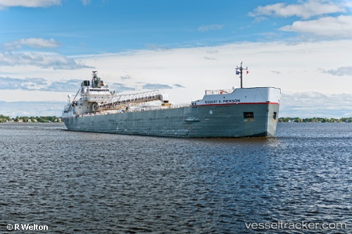
 Robert S. Pierson
Current Status
Where is the vessel?
Robert S. Pierson is currently in 11 nm NW of GODERICH, based on AIS data received about 14h ago.
Latest AIS update:
Current position: 43.87313° N, 81.92866° W (11 nm NW of GODERICH)
Average speed (last 7 days): Loading…
Average speed (last 30 days): Loading…
Vessel profile: Robert S. Pierson is a Self Discharging Bulk Carrier with dimensions 192m x 21m.
This page combines live AIS, route history, probable destination signals, nearby traffic, and port activity for practical vessel monitoring.
The current position of vessel Robert S. Pierson is 43.87313 lat / -81.92866 lng. Updated: 2026-05-20 17:55:29 UTCNearest reference points:
- Near Fort Gratiot
- Near Saint Clair Shores
- Near Walkerville
Currently sailing under the flag of Canada ![]()
Robert S. Pierson built in 1974 year
Deadweight:
20236 tDetails:
Live Vessel Robert S. Pierson Analytics (details, animations, etc.)
Recent AIS points (UTC):
2026-05-20 13:59:40 UTC · 43.74569, -81.72682 · SOG 0 kn · COG 279°2026-05-20 16:21:01 UTC · 43.74561, -81.72611 · SOG 0 kn · COG 279°
2026-05-20 16:42:01 UTC · 43.74605, -81.73153 · SOG 3.4 kn · COG 269°
2026-05-20 17:55:29 UTC · 43.87313, -81.92866 · SOG 11.5 kn · COG 328°