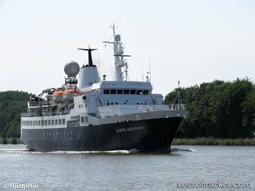
 OCEAN ADVENTURER
Current Status
Where is the vessel?
OCEAN ADVENTURER is currently in Near Birsay, based on AIS data received about 14h ago.
Latest AIS update:
Current position: 59.15374° N, 3.50152° W (Near Birsay)
Average speed (last 7 days): Loading…
Average speed (last 30 days): Loading…
Vessel profile: OCEAN ADVENTURER is a Passenger (Cruise) Ship with dimensions 100m x 16m.
This page combines live AIS, route history, probable destination signals, nearby traffic, and port activity for practical vessel monitoring.
The current position of vessel OCEAN ADVENTURER is 59.15374 lat / -3.50152 lng. Updated: 2026-05-20 01:56:55 UTCNearest reference points:
- Near STROMNESS
- Near Tingwall
- Near Staxigoe
Currently sailing under the flag of Portugal (MAR) ![]()
OCEAN ADVENTURER built in 1975 year
Deadweight:
1465 tDetails:
Live Vessel OCEAN ADVENTURER Analytics (details, animations, etc.)
Recent AIS points (UTC):
2026-05-19 23:07:15 UTC · 58.74133, -3.54304 · SOG 8.3 kn · COG 330°2026-05-20 00:10:06 UTC · 58.89466, -3.59247 · SOG 9.1 kn · COG 3°
2026-05-20 01:15:15 UTC · 59.05270, -3.54067 · SOG 9 kn · COG 8°
2026-05-20 01:56:55 UTC · 59.15374, -3.50152 · SOG 9.1 kn · COG 28°